
HOW TO BUY A PUPPY – TOP TIPS
October 25, 2018
Ahoy Ma Hearties! Panto fun ahead!
October 25, 2018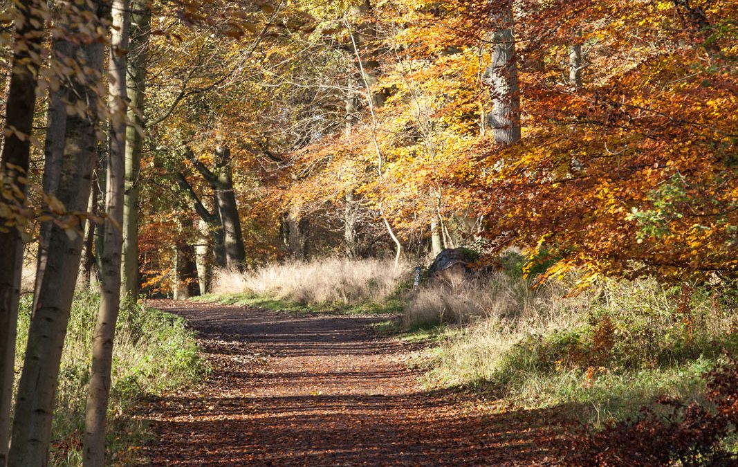
A circular walk starting from the hamlet of Crocker End, through the varied arable and woodland landscape of Lord Alvingham’s estate, passing the ancient ruins of St. James’ Church, with some far-reaching views en-route.
Distance: 4 miles
Start: Informal parking is available in Crocker End around the village green. To ensure that you find the (unmarked) lane which is the start of the walk, please follow these directions carefully.
Enter Crocker End from the signposted turn in Nettlebed, ignoring the turning to Magpies. Keep the village green on your right hand side, passing a red post box on your left hand side. Continue along this side of the green. Park towards the end of the green near to a large cream-painted house (Field House).
The walk starts down an unmarked lane which is on the other side of the green, virtually opposite Field House, between two houses (Bees Cottage and Thatchers Cottage).
Access Information: One steep slope near Halfridge House.
The start of the walk through Crocker End and the section on the restricted byway leading towards the Warburg Nature Reserve are on metalled roads.
Route:
- Go down the gently sloping narrow lane between Bees Cottage and Thatchers Cottage in Crocker End. After a few yards, at the T-junction, turn left. Pass Crocker End Pumping Station on the right at the bottom of the hill. On entering the hamlet of Catslip, at the top of the hill, turn left onto the bridleway, signposted Bix
- At the T-junction, keep left, passing Beech House on your left. Keep straight ahead over a metalled track, passing the distinctive Halfridge House on your left.
- Turn left onto the footpath through Willis Wood Gate, going down a steep slope with woodland on the right and the gardens of Halfridge House on the left. At the bottom of the slope, turn right onto a wide grassy path where it is often possible to see deer. At the bottom of this track, turn right and immediately left, following the footpath signs to continue along a grassy path to a kissing gate
- Continue straight along the bottom of the field to another kissing gate and then straight ahead along a flinty track with lovely open views towards Bix Bottom.
- Go through a kissing gate into the yard of Valley Farm, continue straight ahead to join a metalled road which is the Oxfordshire Way. Turn left (signposted Chiltern Way Extension) passing Valley Farm Cottage on the left. Continue straight on, passing on your left the ruins of St. James Church
- (almost hidden behind the hedge) and staying on the Restricted By-way, ignoring the Oxfordshire Bridleway turning on the right. Pass the sign for the Warburg Nature Reserve and several hundred yards later turn left up a Restricted By-way at Pages Farm
- Continue uphill before entering woodland, heading gently uphill.
- At a junction take the left fork, continuing more sharply uphill. At the top of the hill, there are views of Soundess House on the left. Continue straight ahead, with a high wooden fence on your left hand side. Pass the entrance gates of Soundess House, continuing on a metalled track. After a few yards, bear left through a kissing gate
- heading diagonally across the field (which often has cows in it) to reach another kissing gate. Follow this short, shady path to re-enter Crocker End.


